Tropical Storm Dineo
Taken by Peter Lowenstein on February 17, 2017 @
Murambi, Mutare
Click photo for larger image

| |
Camera Used: Panasonic DMC-TZ60
Exposure Time: 10/600
Aperture: f/3.3
ISO: 100
Date Taken: 2017:02:17 23:28:08
|
|
| More images
Details:
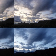
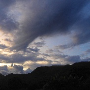
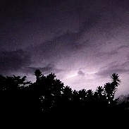
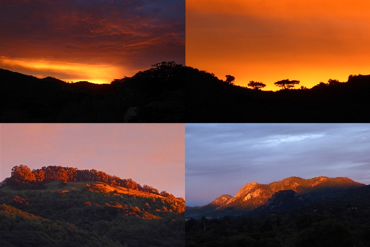
Tropical Storm Dineo, remnant of the first cyclone in 10 years to make landfall from the Mozambique Channel, did not cause serious damage in Zimbabwe and barely reached Mutare. The first sign, on the morning of 17 February, was a strange letterbox sunrise (red sky in the morning, shepherd's warning) which lasted for just four minutes and flooded the horizon above Cecil Kop Nature Reserve and some other mountain tops with bright red light (first mosaic). This rapidly gave way to grey cloud which changed direction several times during the day and produced persistent rain. In the late afternoon the sky started to clear and around sunset a strange funnel-shaped cloud which lasted for 10 minutes appeared over Murambi (second mosaic and third image). Fortunately it did not reach the ground and surface wind speeds remained low. After dark there were some isolated thunderstorms with distant lightning which lit up the sky to the east (video frame capture). These were followed by steady soaking rain which continued well into the night. The photographs were taken using a Panasonic Lumix DMC-TZ60 camera in sunset scenery, intelligent auto and manual video modes.
Photographer's website:
No URL provided.
|
|
|