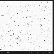
Virgo Galaxy Cluster Map
Taken by project nightflight on April 13, 2012 @
La Palma, Spain
Click photo for larger image

| |
Camera Used: Unavailable Unavailable
Exposure Time: Unavailable
Aperture: Unavailable
ISO: Unavailable
Date Taken: 2014:04:04 14:49:50
|
|
| More images
Details:
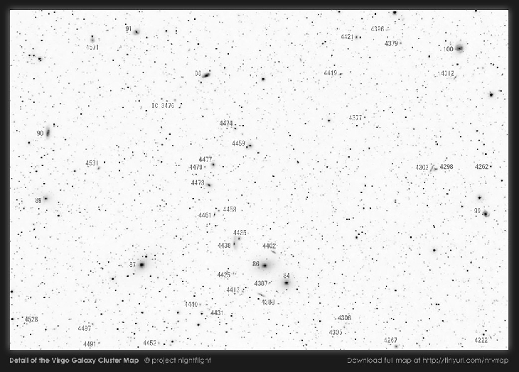
Navigating the Virgo Galaxy Cluster
Spring is the perfect time to explore the Virgo Galaxy Cluster. Even small telescopes show a nice assembly of galaxies.
But with galaxy density unusually high and very few foreground stars a visual observer can easily get lost in the crowded Virgo Cluster. Most maps available, however, are rendered by sky charting software and fail to give a meaningful impression of what to expect in the eyepiece.
Our attempt for a better solution is a photographic chart of the area of interest centered on Makarian's Chain. It was captured in April 2012 under the crisp skies of La Palma island using a modified Canon EOS350D with a Zeiss Sonnar 135mm lens on an Astrotrac tracker. The map was generated using the green channel of a stack of 16 x 4min exposures and covers an area of about 9 x 6 degrees. The limiting magnitude of the finder chart is around 16mag, galaxies down to a visual magnitude of 13mag are labeled.
Observers can use the 5mag star 6 Com on the right border of the map to start a visual tour of the galaxy cluster. 6 Com is conveniently placed about 6 degrees east of Beta Leonis. The complete 9 x 6 degrees chart (0.6MB) is available for download at http://project-nightflight.net/tests.html#virgo_galaxy_cluster_map
Happy galaxy hunting!
Credit: project nightflight
www.project-nightflight.net
Photographer's website:
http://project-nightflight.net/tests.html#virgo_galaxy_cluster_map
|
|
|