Did GGSE-4 nick IRAS?
Taken by Paul Klauninger on January 29, 2020 @
Lanark Highlands, Ontario, Canada
Click photo for larger image

| |
Camera Used: Unavailable Unavailable
Exposure Time: Unavailable
Aperture: Unavailable
ISO: Unavailable
Date Taken: Unavailable
|
|
| More images
Details:
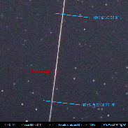
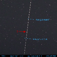
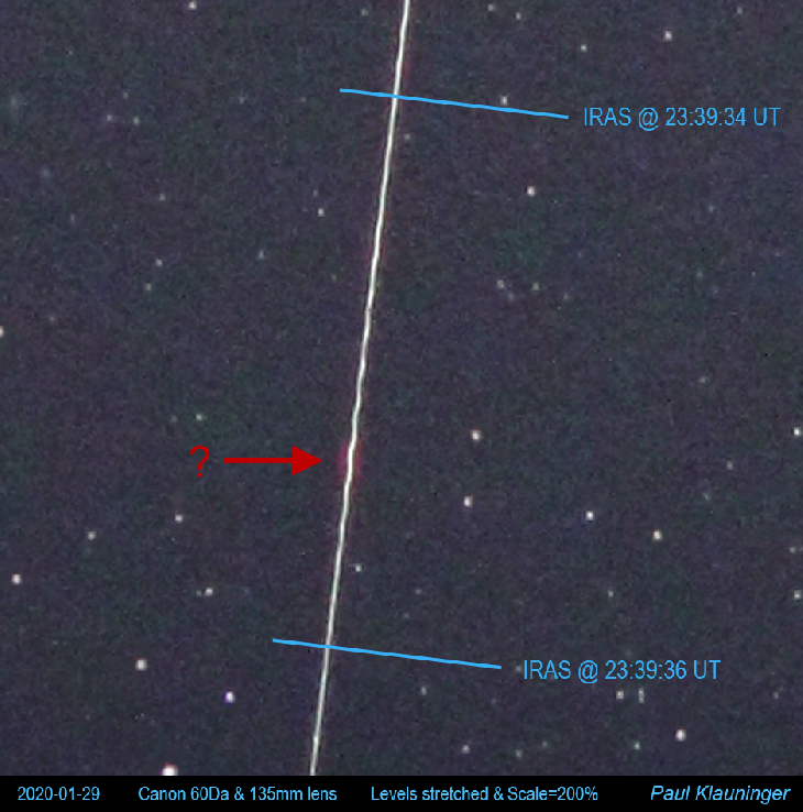
I had clear skies to observe the potential collision between the IRAS and GGSE-4 satellites on January 29, 2020 and so set up my Canon 60Da with a Canon 135mm F2 lens on an Ioptron SkyTracker to image the passage. Predicted magnitudes for my rural location at the critical time of 23:39:35 UT were calculated to be about +5.5 for IRAS (1090 kg) and +8.5 for the much smaller GGSE-4 (85 kg). My image recorded the IRAS track easily but not the much dimmer GGSE-4 track. No collision is believed to have occurred. On examining the image I obtained however, I noticed a very brief brightening in the IRAS track at the critical moment, flanked by a reddening on either side of the path. There is also a bit of a curious undulation in the IRAS track for about one second that is most noticeable around the bright spot. The magnitude of that undulation exceeds any fluctuations seen in the remainder of the captured track that are due to the tracking mount itself (and winds were calm at the time of capture). Latest estimates before closest approach indicated the satellites would pass each other at just 12 meters. So did the GGSE-4 satellite's extended 18-meter boom possibly just brush IRAS? It seems quite coincidental otherwise that the brief brightening and undulation seen in the IRAS track should occur just at that critical time. (Image 1 is a full-scale (non-enlarged) crop from the original full frame and is unprocessed. Image 2 is enlarged by 2X and only overall brightness levels were increased to show the details).
Photographer's website:
No URL provided.
|
|
|