Mysterious Atmospheric Structure
Taken by Laura Kranich on June 14, 2015 @
Kiel, Schleswig-Holstein, Germany
Click photo for larger image

| |
Camera Used: Canon Canon EOS 7D
Exposure Time: 32/10
Aperture: f/2.5
ISO: 640
Date Taken: 2015:10:06 21:58:59
|
|
| More images
Details:
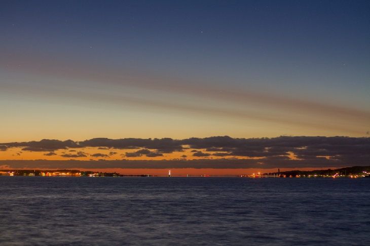
On June 14th/15th, beginning in the late evening hours of June 14th, I saw a remarkable, completely untextured streak over the northern horizon and the Baltic Sea. During the bright summer night in our northern latitudes it slowly moved southwards, though it still lingered relatively low over the northern horizon in the early morning hours.
I found this structure not only on images of webcams looking northward from Kühlungsborn about 70 miles/100 km east of Kiel and from Rügen about 140 miles/220 km east but also on satellite images with the sun at a low angle over the horizon. It was invisible on satellite images when the sun rose higher in the sky, also on like for example hi-res MODIS Terra and Aqua images. There's no trace of it. So I'm pretty sure it was not a common cloud in the troposphere.
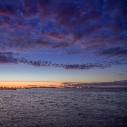
Instead my suggestion is, that it was something like a fire or volcanic plume that had risen to the stratosphere where a lack of turbulence allows for such texturefree clouds when blown away by the wind. Also the cloud was relatively dark compared to other clouds in the sky, which were lit up by the remaining sunlight (see image nr. 2). Moreover the fact that it was visible over great distances would suggest a high altitude phenomenon. I tried to find more satellite images that could indicate a possible cause, but I didn't find any. So I'm posting this here to ask you to give your ideas or suggestions about this thing. Maybe someone already knows the cause?!
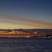
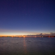
The first closeup image (as a teaser) was taken at 50mm on a Canon 7D (APSC) at 2:13 CEST = 00:13 UTC, July 15th in the morning, the sun was approx. 11° below the horizon.
The second image was taken at 11mm at 23:12 CEST in the evening before (sun @ -7.5°), the third image shortly before the first at 2:06 in the morning. The location from where I observed the sky and took the photos was a pier in the city of Kiel looking towards northwest to northeast.
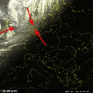
The last image is a satellite image taken from sat24.com from 22 CEST in the evening, you can clearly see the structure over Denmark and Sweden extending towards the Faroe Islands and beyond towards Iceland.
I have never seen any structure like this before in many years of sky observation, so I would really love to find an explanation or other people who witnessed this too.
Also I have some more satellite images of that day and the saved webcam images from Kühlungsborn and Rügen which clearly show the same structure at the same times. I took pictures through the whole night so I also could assemble a timelapse video of the structure's slow movement across the sky.
Photographer's website:
No URL provided.
|
|
|